 |
A Middlesex 1611 - 1836 - Fold Up Map that features a collection of Four Historic Maps, John Speed's County Map 1611, Johan Blaeu's County Map of 1648, Thomas Moules County Map of 1836 and a Map of thPublisher: Historical Images Ltd Year: 04/01/2019 ISBN: 9781844918454 Publication form: paperback
|
117.60 PLN
Product to order
Delivery 3-4 weeks
Add to bookshelf
|
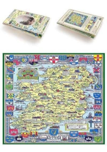 |
Historical Map of IrelandPublisher: Historical Images Ltd Year: 01/01/2019 ISBN: 9781844918492 Publication form: paperback
|
117.60 PLN
Product to order
Delivery 3-4 weeks
Add to bookshelf
|
 |
United Nations Map of The World 1946Publisher: Historical Images Ltd Year: 01/01/2019 ISBN: 9781844918812 Publication form: paperback
|
117.60 PLN
Product to order
Delivery 3-4 weeks
Add to bookshelf
|
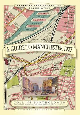 |
Guide to Manchester 1927Publisher: Historical Images Ltd Year: 28/08/2014 ISBN: 9781844918201 Publication form: hardback
|
117.60 PLN
Product to order
Delivery 3-4 weeks
Add to bookshelf
|
 |
A Guide to Birmingham 1924Publisher: Historical Images Ltd Year: 14/12/2013 ISBN: 9781844918225 Publication form: hardback
|
117.60 PLN
Product to order
Delivery 3-4 weeks
Add to bookshelf
|
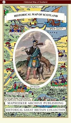 |
Historical Map of ScotlandPublisher: Historical Images Ltd Year: 2019 ISBN: 9781844918515 Publication form: paperback
|
117.60 PLN
Product to order
Delivery 3-4 weeks
Add to bookshelf
|
 |
A County of Sussex 1611 - 1836 - Fold Up Map that features a collection of Four Historic Maps, John Speed's County Map 1611, Johan Blaeu's County Map of 1648, Thomas Moules County Map of 1836 and a PlPublisher: Historical Images Ltd Year: 2019 ISBN: 9781844918270 Publication form: paperback
|
117.60 PLN
Product to order
Delivery 3-4 weeks
Add to bookshelf
|
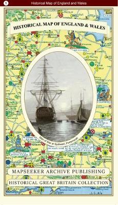 |
Historical Map of England and WalesPublisher: Historical Images Ltd Year: 2019 ISBN: 9781844918508 Publication form: paperback
|
117.60 PLN
Product to order
Delivery 3-4 weeks
Add to bookshelf
|
 |
Historical Map of Wales & MonmouthPublisher: Historical Images Ltd Year: 2019 ISBN: 9781844918522 Publication form: paperback
|
117.60 PLN
Product to order
Delivery 3-4 weeks
Add to bookshelf
|
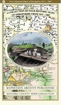 |
A Shropshire 1611 - 1836 - Fold Up Map that features a collection of Four Historic Maps, John Speed's County Map 1611, Johan Blaeu's County Map of 1648, Thomas Moules County Map of 1836 and a Map of tPublisher: Historical Images Ltd Year: 2019 ISBN: 9781844918447 Publication form: paperback
|
117.60 PLN
Product to order
Delivery 3-4 weeks
Add to bookshelf
|
